Nothing can replace real observations in the field. For a couple of decades now, electronic monitoring of environmental processes has been mainstream in science circles. These days, almost every hydrology or ecology researcher has some campaign in progress where electronic sensors are left in the field to gather data. Very often these sensors are left alone for months to years to quietly do their thing while the scientist and crew are busy teaching classes, writing papers, or jet-setting to important conferences.
This all sounds great until something goes wrong in the field, and the data are corrupted, compromised, or lost. We’ve all had it happen: after a year of absence, we hike back to the study site only to discover that a yeti chewed the wires on our electronics and we’re back to square one. Leaving the discussion of appropriate colourful metaphors aside, this is obviously a problem. Even worse, often there is simply a programming or installation oversight that is not apparent until a time-series of the data are examined (graduate students take note!). Many hours have been spent by scientists trying to massage those noisy or strange data into something useful – because that conference abstract or publication won’t wait another season!
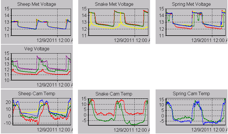
Reducing or avoiding this unhappy occurrence should be paramount for the conscientious researcher, and any major monitoring campaign needs to seriously evaluate options for data connectivity. When you can see your data in real-time or near-real-time, you can rapidly assess the quality relative to expected values. If you are (smartly) monitoring other things on the site, such as battery voltage or other power-system parameters, you can also predict if you will experience a power system failure (the number-one cause of remote site problems, I’ll write a condensed best-practices on this in a later blog entry).
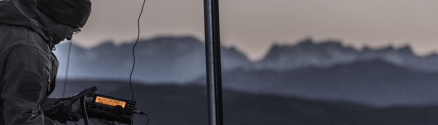
Fortunately, the last 10 years have been a great time to be a field scientist, as technology has come a long way. No longer do you need to know someone at the CIA in order to get data communications into remote locations. Many sensor companies actually offer the option of telemetery, usually a semi-proprietary radio system that will leverage cellular or satellite technology. Sure, the scientist or (more often) their technician needs to get up-to-speed on the technology, but let’s face it: every field of science has mandatory tools that require expertise outside of the pure research. This is one of those technology categories that next-generation field scientists MUST familiarize themselves with.
“This is one of those technology categories that next-generation field scientists MUST familiarize themselves with.”
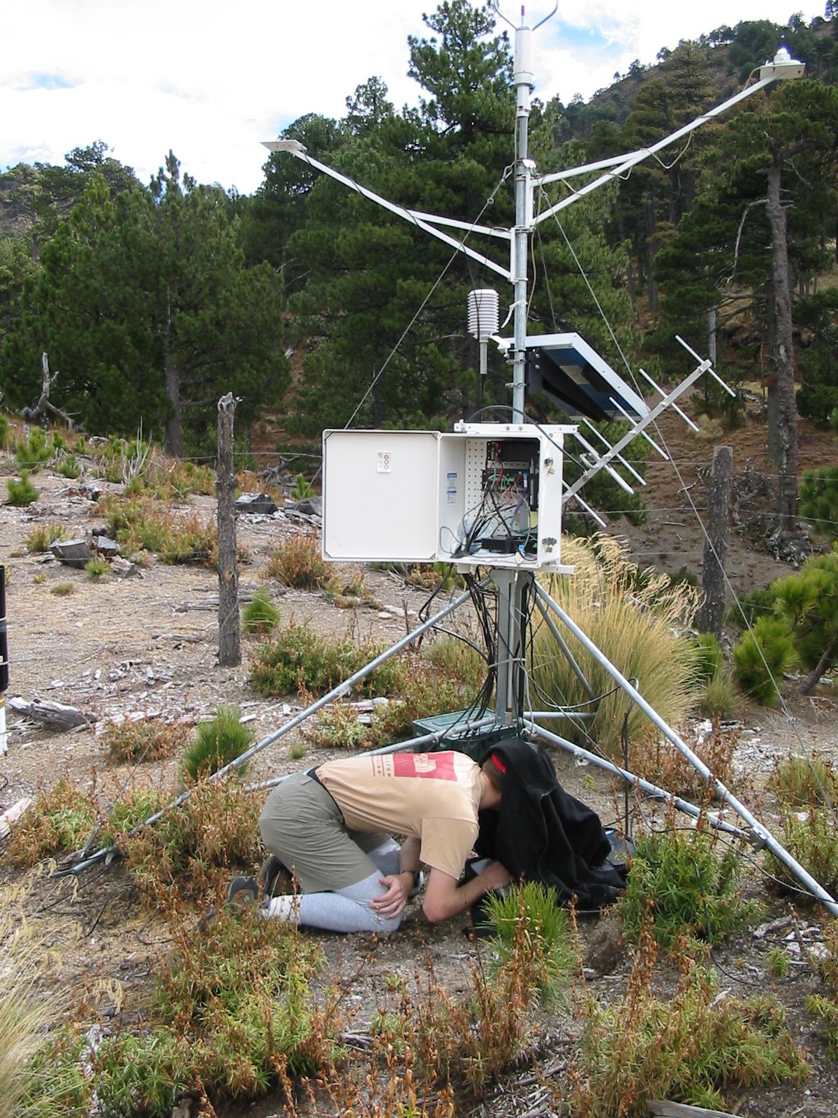
If the scale of the monitoring campaign is sufficient, the project fairly diverse in observation needs, or the intended deployment time is several years, it is highly-recommended that a separate wireless IP field network be established. By moving to IP (Internet Protocol) communications, the project now has the option of adding a number of other devices to the system provided that adequate power is supplied. An IP network is not vendor-specific, meaning that dataloggers, cameras, remotely-actuated relays, and other devices may be connected and configured according to the needs of the project, rather than limited by a vendor’s (sometimes not cost-effective) offerings. An IP network can be extended up a mountain or down a valley, with all devices being accessible from anywhere on the local network.
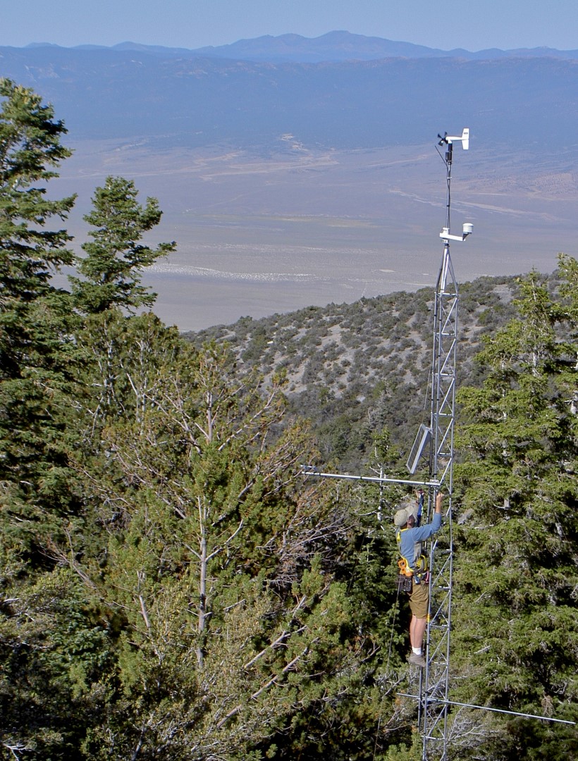
Even if the system is not tied back into the actual Internet at some point (allowing connectivity from anywhere, if configured properly), this still allows access to high-elevation remote equipment from low elevation, or vice-versa, potentially saving a lot of travel time. If mountain sites are inaccessible in winter, for instance, you can still connect from the valley, get your data, and evaluate the state of your systems. There are endless tricks and possibilities even for low-power systems, and with the advent of inexpensive microcomputers (such as Arduino and Raspberry Pi), the sky is literally the limit on what an ingenious field tech can do with the electronics.
Hopefully it is pretty clear at this point how building in connectivity can be helpful, cost-effective in the long-term, and even save you from science heart-ache. For more detailed information on how to plan and implement remote monitoring systems, go to the Federation of Earth Science Information Partners (ESIP) Best Practices wiki page maintained by the Envirosensing Cluster. Ask myself or any of the other co-authors about our experiences, we’re usually pretty responsive. Better yet, subscribe to the Cluster’s email list and post your questions there.
PS – I’m predicting right now that as soon as the whole legal/licensing situation with drones and research is cleared up, they will play an important part in field data connectivity. I know how I want to use them – just sayin’.